Summary and Images
(Click on these thumbnail images to view a larger image)
David Cook writes:
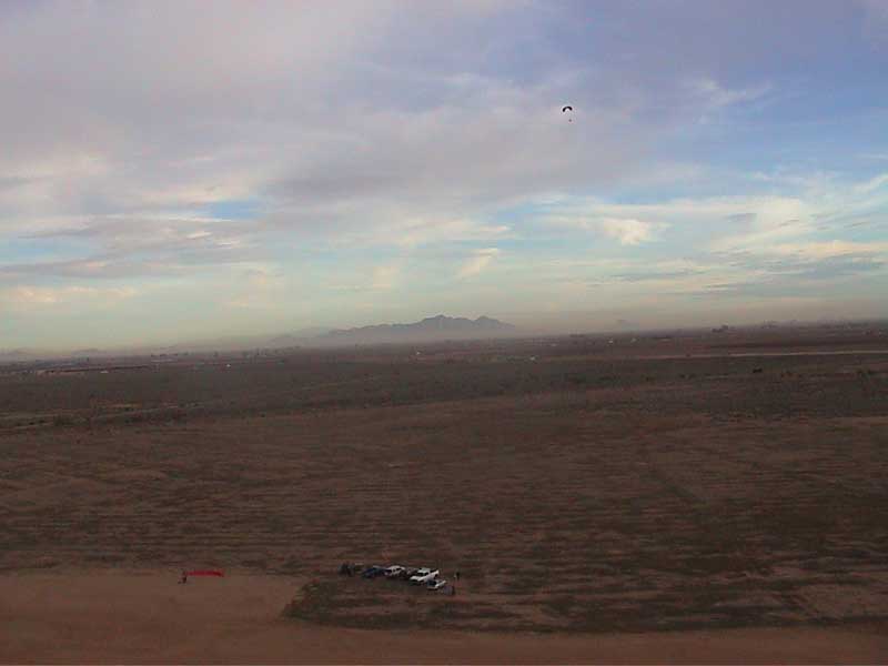
Mike and I from Tucson met the Phoenix pilots half way between Tucson and Phoenix at the McCartney site at close to 4pm. Pilots were Scott, Maurice, Tony and myself. Mike contacted his friend Jerry (spelling?) from Phoenix, so Jerry was also there. One thing after another led to just Maurice and I getting in the air. I managed a long run on take-off during a forward launch in a 4-to-6 mph east breeze. Climbed up and took off cross-country 5 miles to the east to Signal Peak in the Sacaton Mountains. After flying over the peak, I followed the ridge of the Sacatons for three miles to the radio tower on the highest peak in the range, which interestingly, does not have a name. The radio tower on this peak is at 2296 feet msl. For reference, the McCartney site is at 1476 feet msl. By the time I got to the radio towers, I was about 1500 feet over the peak. I then flew 6 miles back to the McCartney site, all the while climbing. When I arrived back at the site, after a total of 14 miles round trip, I was probably near 5000 feet agl. Views were beautiful all around. I could see the Catalinas and Picacho Peak that I know so well, and other distant mountains that I do not know. When I arrived over McCartney, I killed the engine and did some gentle spiraling turns and pulled big ears to loose some altitude. Even with that, it took me a very long time to get down. I set up for a nice dead-stick landing by my truck, only to discover, when I was 40 feet off the deck, that I was landing down wind! I took a wrap and flaired so as to keep me parallel to the ground for as long as possible, just a few feet off the ground, and then ran the landing out nicely. Whew!
A topographic map of the Sacaton Mountains can be found at
http://terraserver.homeadvisor.msn.com/image.asp?S=14&T=2&X=136&Y=1140&Z=12&W=2
David, Great report! And I really enjoyed those pictures you took, especially the one where you are really high up looking down at the site. Those giant crop rings look so small!!! You know, I have never flown past about 3000' AGL. One of these days I'll give this a try to go higher just to take in those magnificent views and push my boundaries (ie. my fear of heights which incidently hasn't been an issue for me in a long time).
Conditions were ideal, with really laminar, glassy air from 3-6 mph. I got in about 5 flights total, with a few land and goes. The bright, almost full moon made for a nice landing on my last flight.
I mainly stayed near the LZ, since I brought my son with me and I wanted to keep an eye on him from the air (and to let him keep an eye on me too to know I wasn't far). Besides, someone needed to keep the groupies entertained!
Also, Scott was generous enough to let me try his Advance wing: a very sweet wing, nimble, responsive, and about double the glide/climb ratio of my trusty, old Symphony. Also, I liked the design of the built-in big ears toggles: they worked flawlessly in flight. The only drawback of the wing is that it seems difficult to inflate in 0-3mph winds, which makes for some frustrating forward launches. But this could just be me and this situation could probably be remedied with an afternoon of kiting practice with the wing.
Lastly, I took some video from the air, but it really didn't turn out too well. Bummer. Maybe next time.
Scott Malone writes:
Thanks to Tony, Mo and David. It was fun even though i did not get to fly.....I ordered the part i need for my Carb. Does anyone know where to get parts for a Tilotson Carb locally? Hey Mo and David maybe by saturday we can try it again.
Images
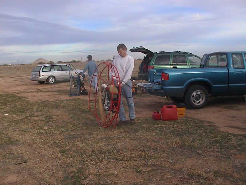
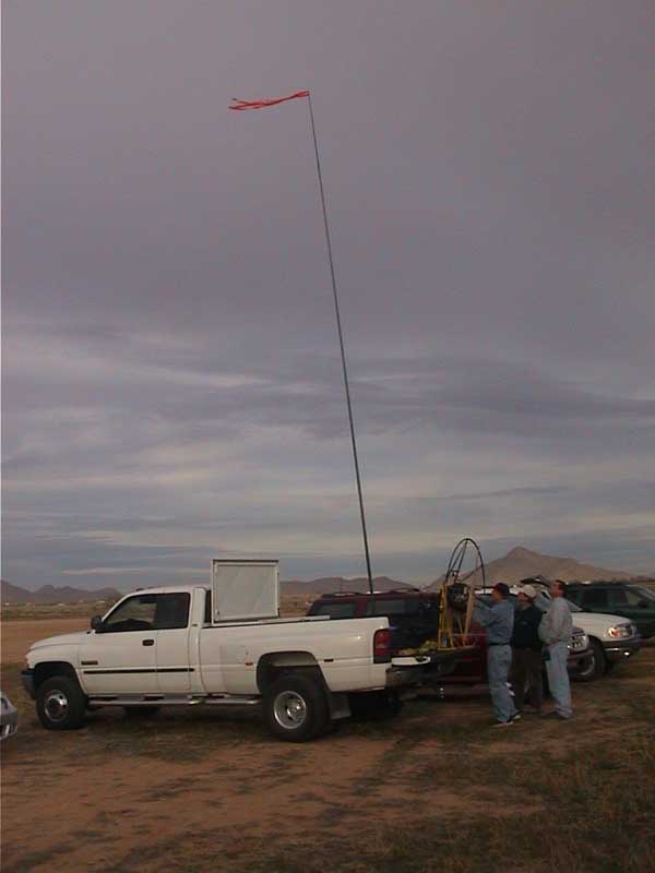
Scott showing off his big stick.
Warming up.
A view from the air.